Saturday, March 28, 2015

GEOENGINEERING WATCH

While Geoengineering has little to do with this case; this information needs to be brought forward and exposed so something can be done to stop it. > go to: http://www.geoengineeringwatch.org/

AEROSOL PARTICLES CAN RE-LOCATE STORMS
Tiny aerosol particles, whether they come from a natural source like a volcanic eruption or from an artificial source such as the payloads dropped by planes engaged in geoengineering activities (“chemtrails”), are well known to decrease or totally eliminate rainfall from clouds (http://news.stanford.edu/pr/2007/pr-slowwind-012407.html).  

In this case they delay its fall so long that the eastern part of the country is now receiving what would normally have been the California winter rain.  The tiny particles make this happen because the water vapor needs to condense around solid particles in order for the vapor to gather into larger drops heavy enough to fall to Earth as rain.
The chemtrail planes carry nano-sized (extremely small) particles of aluminum and other toxic heavy metals along with biologicals like viruses and “mystery fibers,” etc.  When these tiny particles enter the clouds, they supply too many nuclei to the water vapor, and the drops that form around them are too numerous and small to become rain. They continue riding the west-to-east wind across America and finally gather into big enough drops to become rain or snow.  

California is thus in a parched condition, with disaster fast approaching, and the public lulled to sleep by the criminal mainstream media reporting on the drought as a natural occurrence that just happens once in a while by itself.  But then, if you are informed, you know that today’s mainstream media in America is the owned and controlled mouthpiece of a few huge corporations (http://www.pbs.org/wgbh/pages/frontline/shows/cool/giants/), and its job is to follow corporate orders, and tell you what to believe.  Its function has nothing at all to do with telling you the truth.  

Relying on it for your information on what is going on in the world is a huge mistake, unless of course you really don’t want to know. > read more @ http://www.geoengineeringwatch.org/red-alert-engineered-drought-murdering-california/

Wednesday, November 26, 2014

BOULDER RIDGE IN SOUTH SAN JOSE, CALIFORNIA

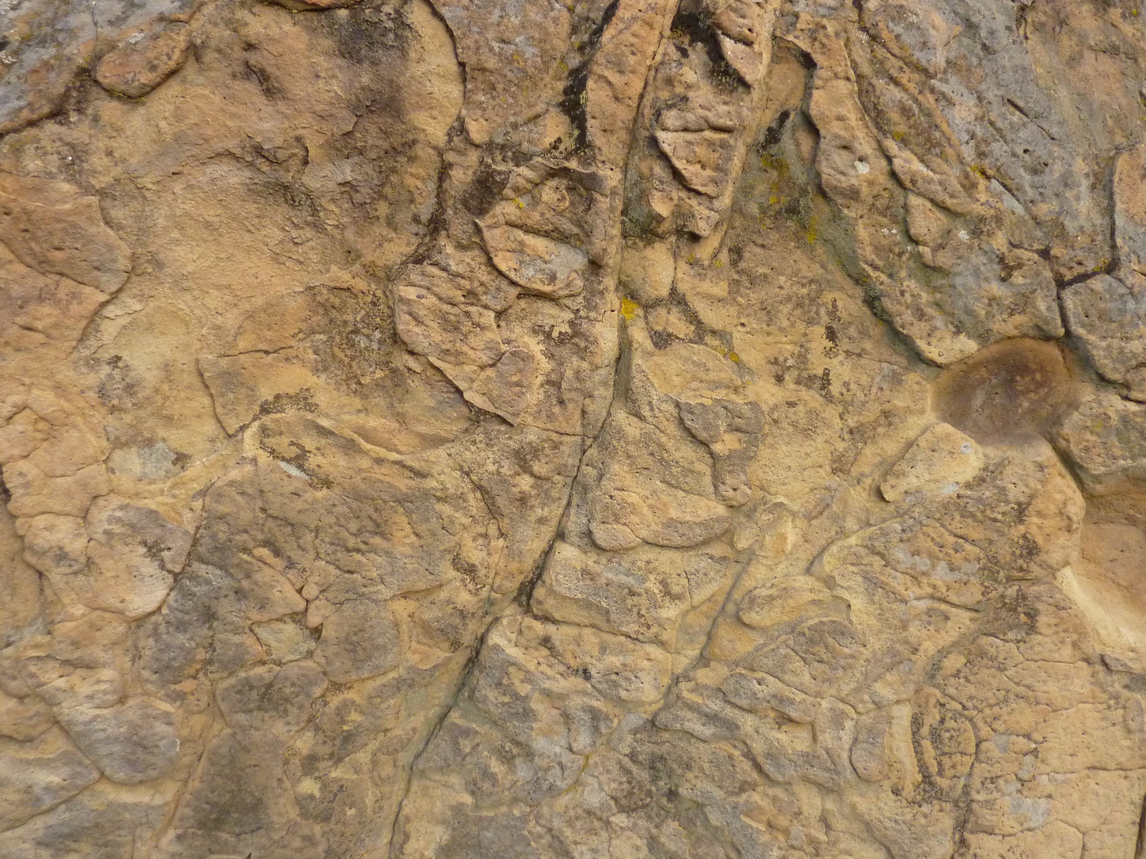
BOULDER RIDGE GOLF COURSE IN SOUTH SAN JOSE: Do these boulders found along the ridge of a mountain leading to Boulder Ridge Golf Course show a high energy outcropping of highly eroded rocks which at one point likely were either submerged in water and/or at water's edge; likely back when the Central Valley in California was the largest body of freshwater in the world after the last ice age? (see above photo and/or go to: http://likroper.com/P1020618.JPG + see also: http://en.wikipedia.org/wiki/Outcrop
High energy outcroppings @ Boulder Ridge Golf Course
A simple explanation of this suggests that while large quantities of ice caused glaciation in the Sierra Nevada mountain range; heavy snow pack remained on the Santa Cruz mountains as well until the end of the last ice age (one of several ice ages) when this snowpack finally melted and formed a huge ancient freshwater lake (X = Boulder Ridge Golf Course). Note: This fresh water lake was mainly fed by the Pajaro River.

SEE GOOGLE EARTH MAP BELOW  
FREE Google Earth download @ https://www.google.com/earth/ 

But a more complex explanation could be within this (see photo below): It is widely accepted that the Central Valley region (D) was at one point in history the largest body of fresh water on earth (note: the Sacramento region [D] lies below sea level). Fed by glacial runoff from the Sierra Nevada mountain range; most of the runoff initially exited through the Monterey Bay region and/or Soquel Canyon (A); until a large earthquake occurred at the Carquinez Straits (C); allowing water from the Central Valley region to spill into what is now the San Francisco Bay region; flooding the entire region and ultimately exiting through the Golden Gate.

Another theory is based upon ancient Native American legends suggesting there was once a Golden Gate land bridge (B) that broke open when a large earthquake occurred along the San Andreas fault. In this theoretical scenario; the entire San Francisco Bay region was part of that initial body of Central Valley fresh water; when activity on the fault broke open the land bridge and created the Golden Gate (B). Adding to this; inhabitants who supposedly lived on dry land outside of what is now the Golden Gate (B) were then allegedly submerged under water!?  

Another possible scenario mixes together both theories: the large earthquake mentioned in Native American legend perhaps actually happened at the Carquinez straits; allowing water to flow into what is now the San Francisco Bay region; eventually eroding and breaking open what would later become known as the Golden Gate.

Saturday, February 1, 2014

THE RAIN DANCE

THE RAIN DANCE -- Did you know that during all three Woodstock festivals; the jet stream pulled down over the Woodstock region causing it to rain by the end of all three festivals? And why is this? Storm systems gain energy from heat and/or are attracted to electromagnetic sources (among other sources; like energy vortexes which feed subtropical and/or hurricane level storms; usually caused by remote seismic activity and/or nuclear testing; and generally emanate from the ocean bottom in the tropics). 1) Since large crowds of people generate heat and electromagnetic energy; and 2) Since storm systems do not discriminate between heat sources and/or electromagnetic sources...so what am I getting at here? Large concerts need to be arranged with this rainmaking ritual in mind to bring much needed precipitation to the west coast of North America; or where ever else it may be needed in the future. Perhaps one three day concert festival in California up in the Sierra Nevada mountains to start the electromagnetic "pull" south then eastward (using the energetic mass of the mountains for greater effect -- just as an experiment. As mountains tend to focus naturally occurring electromagnetism); then perhaps yet another in Colorado over the next three days at high altitude as well to possibly concentrate this energy and help move it eastward. Because I theorize that back when there were hundreds of thousands of indigenous peoples here on the North American continent; these rain making rituals were very real and effectual > go to: http://en.wikipedia.org/wiki/Rainmaking_(ritual) 

> Note: People often complain about 1%ers because they have so much money -- the other side is this; 99%ers have lots and lots of people 

SEISMIC/METEOROLOGICAL CONNECTION?

Stronger trade winds have allowed warmer waters to extend deeper, which contributed to Super Typhoon Haiyan's power. Note: Japanese scientists concluded during the late 1990s that energy actually "wells up" from the ocean bottom to feed hurricanes...

A SIMPLE CAUSE AND EFFECT EQUATION?
1) OFFSHORE HONSHU, JAPAN EARTHQUAKE 25 OCTOBER 2013 - MAGNITUDE 7.1 @ http://earthquake.usgs.gov/earthquakes/eqarchives/poster/2013/20131025.php + 2) EASTERN TAIWAN EARTHQUAKE - 31 OCTOBER 2013 - MAGNITUDE 6.3 @ http://earthquake.usgs.gov/earthquakes/eqarchives/poster/2013/20131031.php = 3) SUPER TYPHOON HAIYAN - 7 NOVEMBER 2013 http://www.ospo.noaa.gov/Organization/History/imagery/Haiyan/index.html + http://www.pbs.org/wgbh/nova/next/earth/anatomy-of-a-super-typhoon/

THEORETICAL EXPLANATION: Friction energy emanating from remote seismic occurrences travels through the earth; tending to discharge in temperate tropical zones; causing topical depressions and hurricanes etc to form -- much like how electricity naturally attracts to heat instead of cold...

Sunday, April 14, 2013

MORE EVIDENCE OF ANCIENT CIVILIZATION?

X,Y AND Z MARK THE SPOTS -- if you look closely at these photos; X, Y and Z show what appears to be artificial formations on the bottom of the ocean off the coast of Antarctica and/or Australia. Is this perhaps even more evidence of ancient civilization? > see also: http://lreresearch.blogspot.com/2013/04/ancient-archaeological-artifact-complex.html

Saturday, April 13, 2013

ANCIENT ARCHAEOLOGICAL ARTIFACT COMPLEX?


IF YOU LOOK CLOSELY AT THIS PHOTO (click on photo); the seemingly artificial-looking lines on the bottom of the pacific ocean that correspond to points 1X and 2X; BOTH INTERSECT AT EASTER ISLAND. While points 3X; 4X; 5X and 6X all correspond to other lengthy ocean-bottom lines which seem to all lead to point A; with point B appearing like a similar semi-centralized point. This suggests that easter island is perhaps only a very small portion of a much larger complex of ancient archaeological artifacts > go to: www.google.com/earth/

Saturday, March 2, 2013

2004 TSUNAMI/GAMMA RAY BURST CONNECTION?

GAMMA RAYS BURSTS are likely relatively common events in the universe; but the burst that occurred the day after the tsunami of 2004 was out of the ordinary. And since large earthquakes are relatively common; seismic friction energy alone could not have been responsible for such a seemingly severe cause and effect reaction light years away. (note: all evidence is anecdotal; therefore unprovable -- but when you stack up 100 pieces of anecdotal evidence over time; that said evidence then becomes less anecdotal and more concrete) 

But! it is not often roughly 300,000 people perish all at once like during the tsunami of 2004; so is this direct evidence that when a critical mass of energy exits one dimensional realm to enter the inescapable grip of a black hole; it then emanates back outward to "re-seed" the universe with recycled energy and/or matter; continuing a seemingly eternal process that may have never started; and may never end; playing some mysterious role we have yet to fully understand? SEE ALSO: TSUNAMI / GAMMA RAY BURST CONNECTION?